A first week of pulling our sledges up the beautiful Kara-Say valley, fuel problems and some summit attempts in the Ak-Shirak range.
In the last few days before leaving we finished all the kit preparations, and after a stressful transit via Lyon and Istanbul airport (we had over 200 kg of gear) we made it to Bishkek. There we were warmly welcomed by Mathieu and Caroline, who gave us a place to sleep, and Alex, who had helped so much with the logistics. Two days of shopping and repacking and we were on the bus to Karakol.
Next day was the 15th of March, the first day we would be in the mountains…
Waking up at 6:45 in the guesthouse I looked out of the window. Five centimetres of fresh snow covered the streets. Forcing breakfast down, worried about the conditions on the pass, we discussed the possibility of being set back by the snowfall. But we were soon packing our stuff in to the 4×4 and heading out into the real, cold and beautiful Tien Shan. The drive took us along the sides of Issyk Kul, before entering the Barskoon pass. Here we drove up behind large lorries, carrying tanks of petrol to the gold mine. As we reached the Ara Bell plateau the view took our breath away. A vast plane of black rock and white snow, with pyramid shaped peaks off in the distance. Even though there was not much snow, we could make out the overhanging glaciers on some of the peaks.
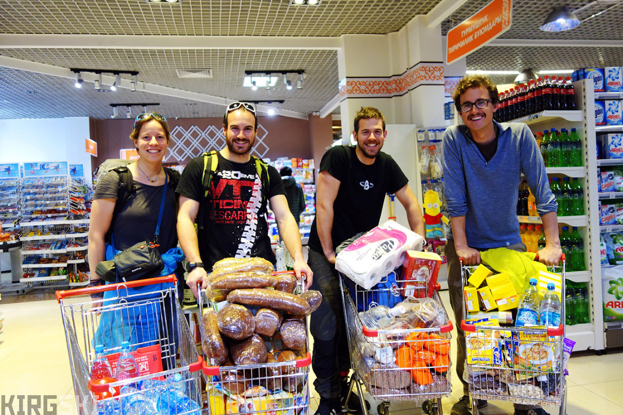
Bshkek, Kyrgyzstan. Shopping for three weeks worth of food in the supermarket. I’m accompanied by Sev, Nico and Alex.
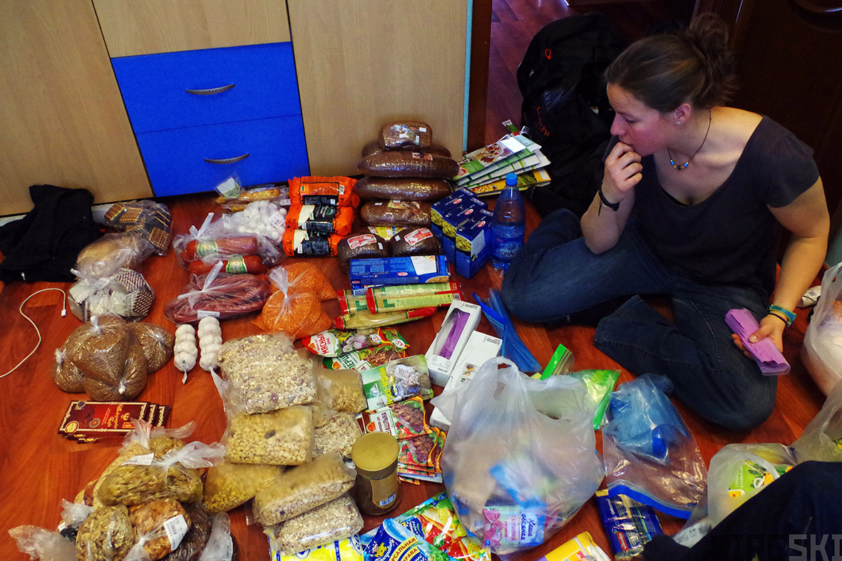
Bishkek, Kyrgyzstan. Sev goes over the different food items and starts organising everything into meals.
Diary entry. Tuesday, 15th March: “Beautiful country, but not much snow. Will we be able to ski the Kara-Say valley? As we arrive at Suek1 another 4×4 in front. We wait as it tries to get up a snowy slope but can’t. We go, and get up, and arrive at the col. The car, following in our tracks points out we have a flat tyre”
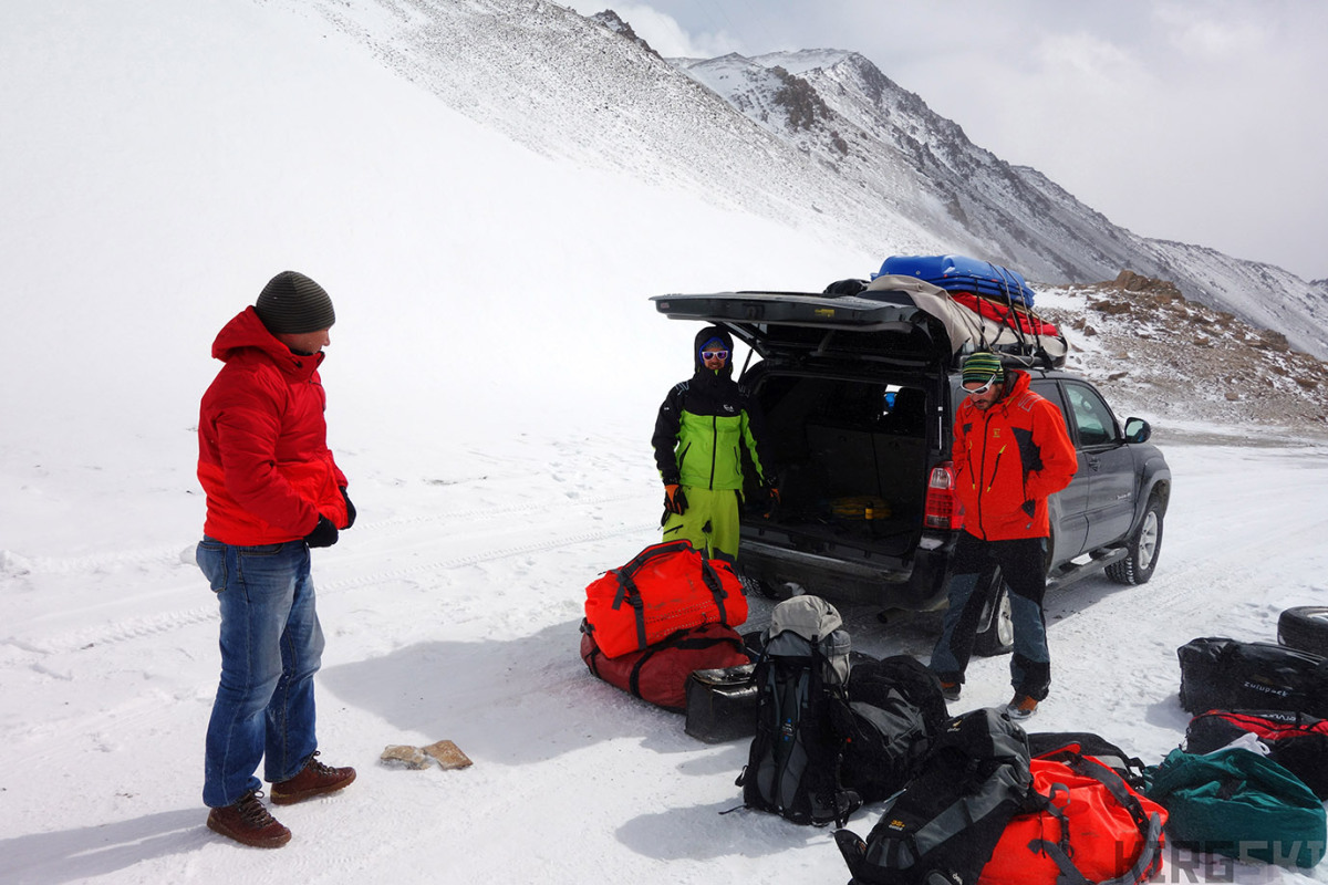
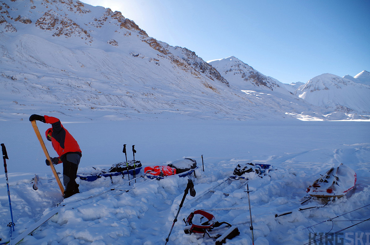
Thanks to Timur’s competence and some help from Nico, the tyre was soon replaced and we were rolling again. It was then we realised we had made it over the Suek Pass, and were finally on our way towards Kara-Say! With the final logistic hurdle overcome, all looked well as we drove over the mountains at 4000m. After showing our border passes at the military check point, we arrived at the Kara-Say bridge. The satellite images we had looked at showed it was broken in the middle, but luckily it had been rebuilt! We left the road behind and followed a fading dirt track towards the north. Stopping at a snow drift, we could go no further. The weather was awful. Unpacking in the gale, it was very cold. We decided to use the afternoon to set up camp (Camp 1 Alt 3620m 41°39’52.19″N 78° 5’19.73″E) and sort ourselves out. First set of problems with the stove, we couldn’t get it to work after several hours in the cold. The satellite phone wasn’t working either and we hadn’t received any text messages. Having discovered that what we though was one weeks’ worth of lentil soup was in fact dried mustard we turned the lights out at half past eleven, completely frozen. Exhausted, we were still full of hope for the next day..!

Road A363, Issyk Kul Oblast, Kyrgyzstan. Timur check over the ties holding down our sledges on the roof of the 4×4. The rough terrain will put the knots to a severe test.
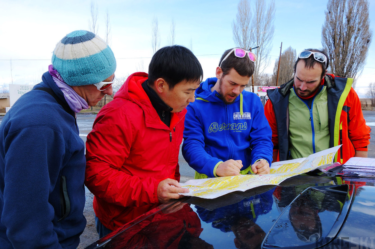
Road A363, Issyk Kul Oblast, Kyrgyzstan. I go over the last route details with Timur, as well as checking possible plans A,B,C… in case of bad weather or not being able to recross any of the passes.
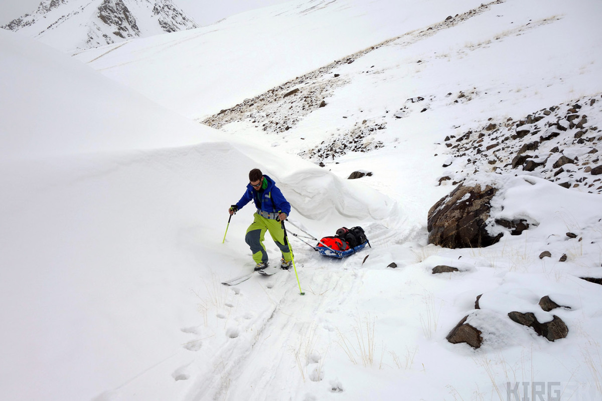
But next morning (16th March) we were still having problems with the stove, so we decided to stay put until it was working. We considered the option of contacting our driver if we couldn’t get them to work (feeling like idiots) but after a mornings work, I finally got one of them going and we were able to melt some snow. Much happier, we took down the tent, not without the difficult task of getting the tent pegs out of the frozen ground! Setting off on foot, we started pulling our heavily loaded pulks. Having not gone far, one of the sledge hauling shafts broke due to a defective rivet.
This was quickly mended using duct tape and some wire meaning we were able to keep going. It felt like a race against time, as only the small amount of snow that had fallen on our first day covered the ground and kept us from dragging on grass and rocks. The countryside was barren, with the stark peaks jutting into the sky at the end of the valley. The snow highlighted the tufts of grass and rocks sticking through. I’ve already mentioned that Kyrgyzstan is a land of contrasts, and the local lexicon seems to have adapted to these opposites, especially for place names.
The use of ak (white) and kara (black) is predominant throughout the language. It is therefore not surprising that the mountain range we were spending our time in is called Ak-Shirak, meaning “white legs2”, and that we were hiking up the Kara-Say “black riverbed” glacier. Other examples of this dichotomy are Karakol “black hand”, the last town before leaving into the mountains, or the Ak Su “white river”, which flows through the Tien Shan into China, giving its name to one of the oasis towns on the borders of the great Taklaman Desert.
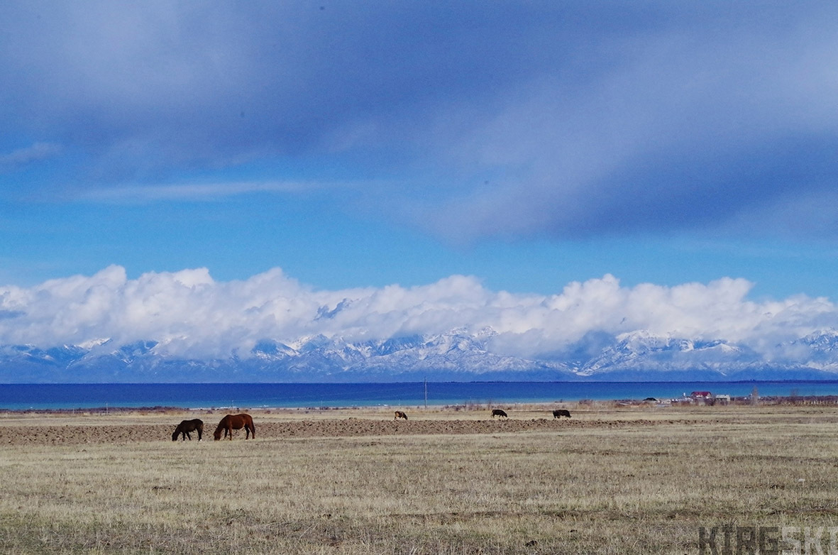
Road A363, Issyk Kul Oblast, Kyrgyzstan. Heading towards the Suek pass we watch the horses grazing in front of Issyk-Kul lake.
We set up camp (Camp 2. Alt 3700 m, 41°40’48.97″N 78° 7’32.52″E) quite early and had our first really supper so far: soup and some bread, horse sausage and cheese. We spend the evening arguing about the maps and use of the different coordinate systems. Our third day (17th March) saw the return of our stove problems. Without managing to get it to work we continued our steady march on foot. We argued about using the frozen river to speed up our pace (rather than pulling over the rolling terrain) but decided to stay on the safe side (three votes against one).
After a windy meal behind a solitary stone we finally put our skis on and skied down onto the river delta, that was completely white. Nico set the precedent of making the trail through the snow, something that would be a common occurrence in the days to come. We set up camp (Camp 3, Alt 3740m 41°44’12.73″N 78°12’44.24″E), near the divide between South and North Kara-Say valleys.
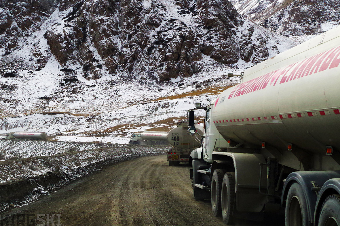
Barskoon Pass, Kyrgyzstan. A steady stream of huge tankers drive up the pass, taking their liquid to the gold mine.
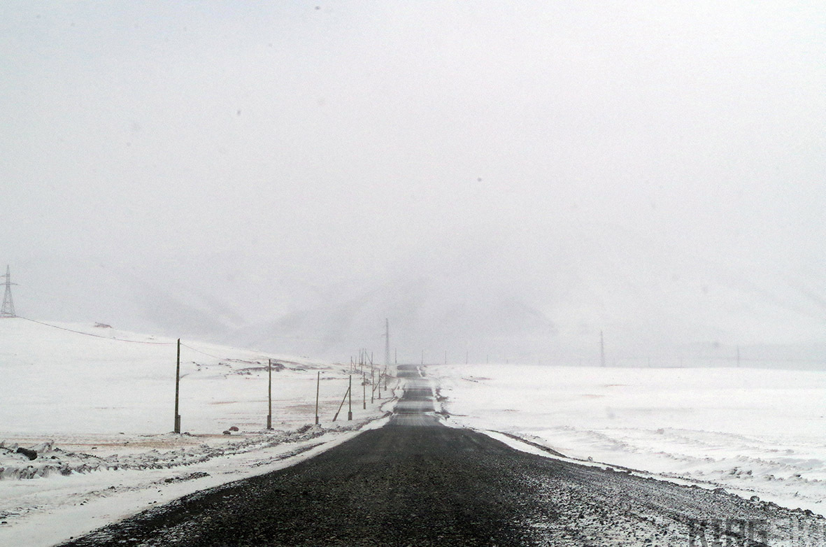
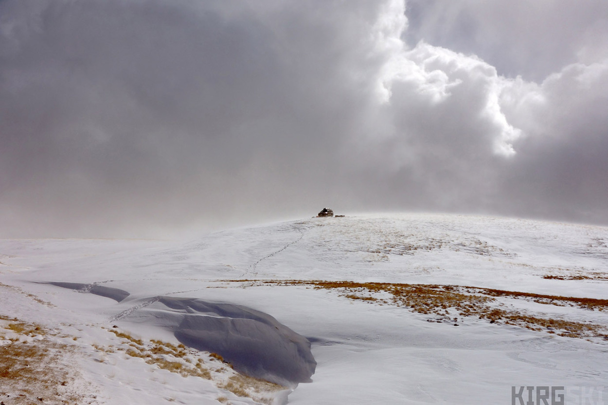
Ara Bel plateau, Kyrgyzstan. The road across the Ara Bell plateau is already at ·3700m. We need to cross it before accessing the Suek Pass, our last serious obstacle before reaching our destination
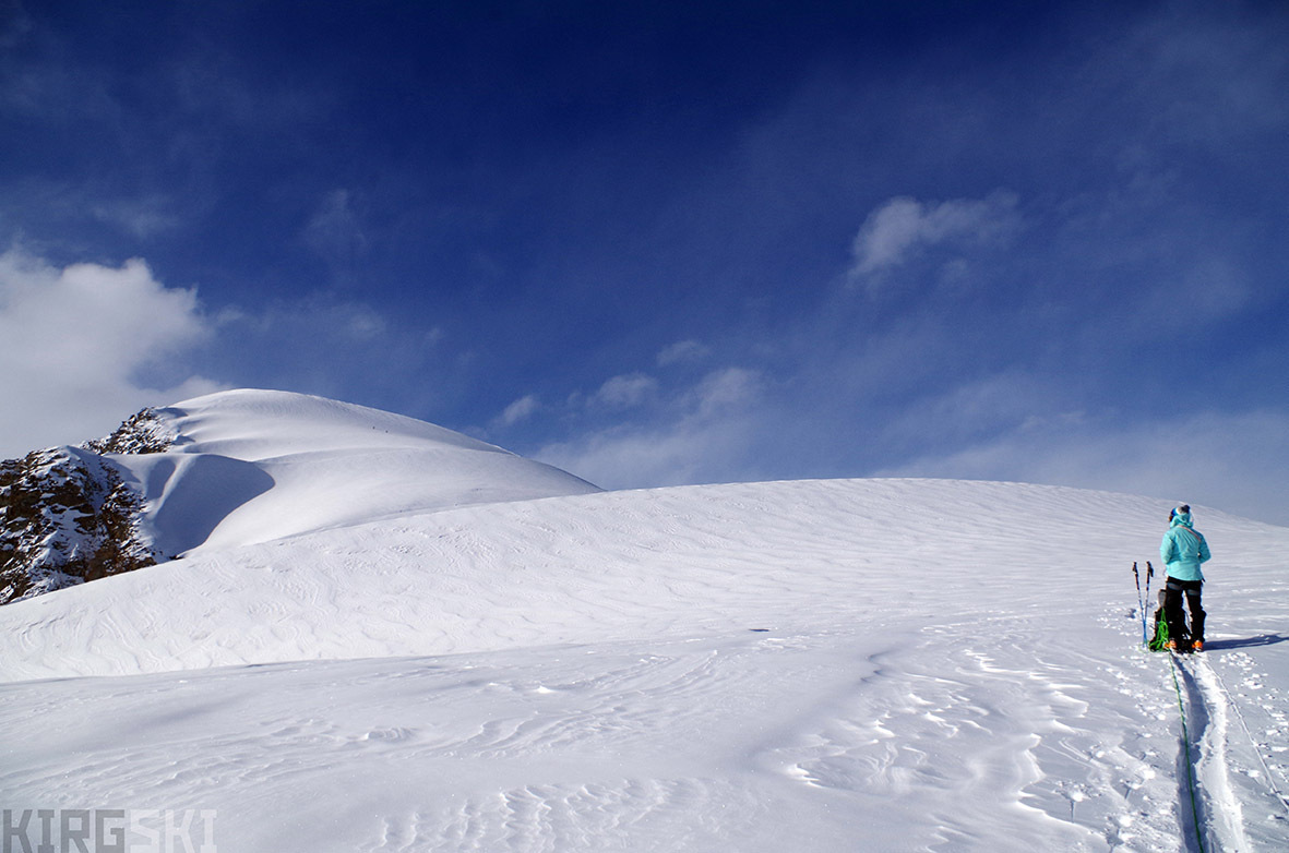
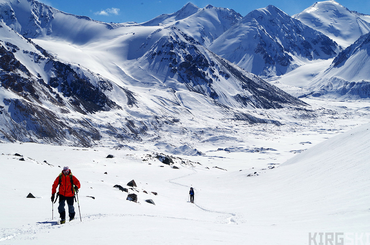
So far we had made it up most of the flatter part of the valley, and could already see the seracs, crashing down from the South Kara Say glacier in front of us. Hidden behind the moraines slightly north-west of us was the North glacier we were hoping to start ascending.
The snow would definitely help our progress, even though we were still worried about the skiing prospects on the peaks, as those around us were still pretty bare. But all this was secondary to the unattractive prospect of having no working stoves on the glaciers jeopardising the whole trip. We therefore decided to call Timur the next morning on the satellite phone and ask for a burner and gas bottles.
He replied immediately and said he would meet us that very day between 4 and 5 in the evening. Nico and I set off in the early afternoon to retrace the previous day’s tracks, while Sev and Arnaud set of to find the trail up the glacier. Arriving at the drop-off point we had about an hour to wait, so dug a snow shelter to get out of the wind and snow. Looking out a few minutes before 4 pm, the 4×4 was coming over the horizon. We packed the gas and stoves up and set off on the march towards camp under the falling flakes. Arriving back at Camp 3 Sev and Arnaud where already back and everything was covered in 10-20 cm of powder.
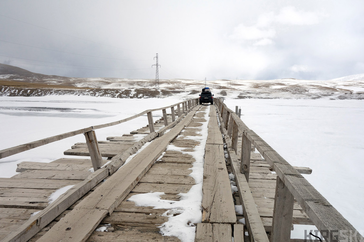
Kara-Say bridge, road A364. The bridge crossing the frozen river has been mended and it allows us to gain the east side and keep heading up the valley
Suek Pass, Kyrgyzstan. At 4000m, we just realise we have a flat tire. Nico and I unload everything so Timur can access the spare tyre and chage it in the freezing cold
Saturday morning (19th March), with the confidence of being able to cook and melt water again, we set off through the base of the moraine. Even following the path that had been scouted out the previous day, we still had to carry our pulks across several sections of rough terrain, including pushing them down a steep slope.After navigating the rocky end of the moraine, we were back on a flat delta, which we crossed, arriving and the base of the Kara-Say glacier. Setting up camp (Camp 4 Alt 3820m41°46’35.48″N 78°12’59.18″E ) at 4.10 pm we sampled the grechka (buckwheat) we had bought in Bishkek. It was excellent, and we realized we had a lot more than bargained for.
Diary entry, Saturday 19th Marc. Set up camp just before Kara-Say ice […] Emilie had texted us forecasting sun for two days, so we decided to keep the camp and go skiing and try some peaks.
Kara-Say valley. The deep snowdrifst finally cut off our progress and we are forced to unload in a raging blizzard.
After an extremely cold night, we were woken by a beautiful day. With several accessible looking valleys around us we decided to go skiing. Starting up the valley just southwest of our camp, we soon realised that the snow conditions were far from ideal. With almost 50 cm of depth hoar, the whole pack was seriously unstable. With Nico in the lead, every so often a “whoumph” noise would indicate the different layers loosing cohesion, and we could see the cracks running out around us. This would be the type of snow we would be dealing with for the next weeks.
Combined to the presence of several plaque avalanches that had come down on the north-east faces, we were not going to get too confident! Even so, it was a great day, with the team splitting into two groups. Nico and Arnaud headed south and up the ridge to climb Pic Moutarde (4400 m. 41°75382 – 78°20038) while Sev and I followed the glacier up a bit higher before gaining the same ridge, taking our skis off and finishing on the rocky Rocher Rechaud (4420 m, 41º75143 – 78º18769).
Kara-Say valley, Kyrgyzstan. As we unload our gear from the car, it quickly becomes covered in snow before we have time to set up the tent
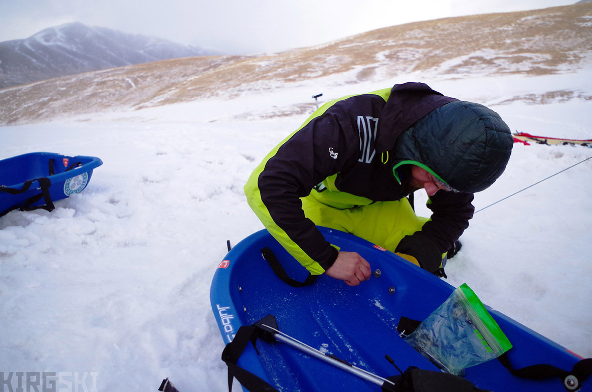
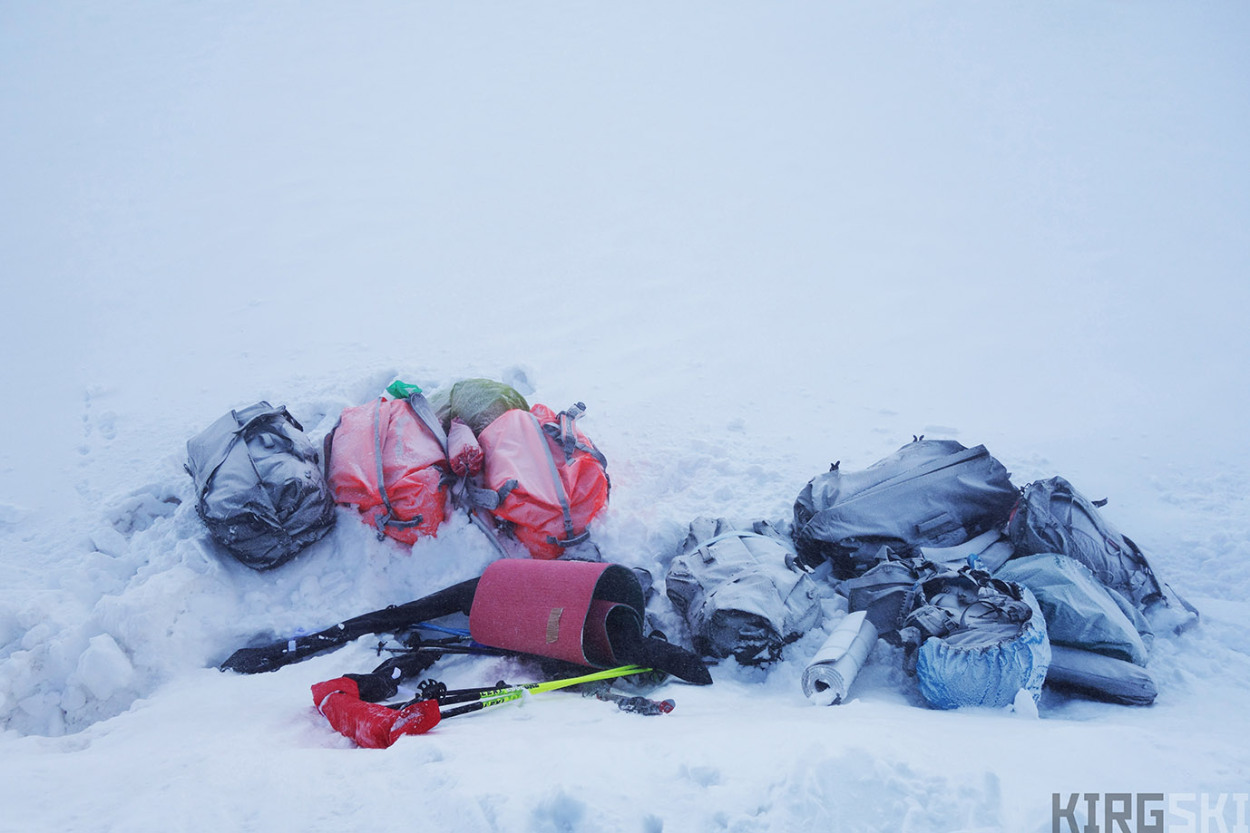
Once we on location we can start to put our sledges back together, and prepare them for pulling our loads up the valley
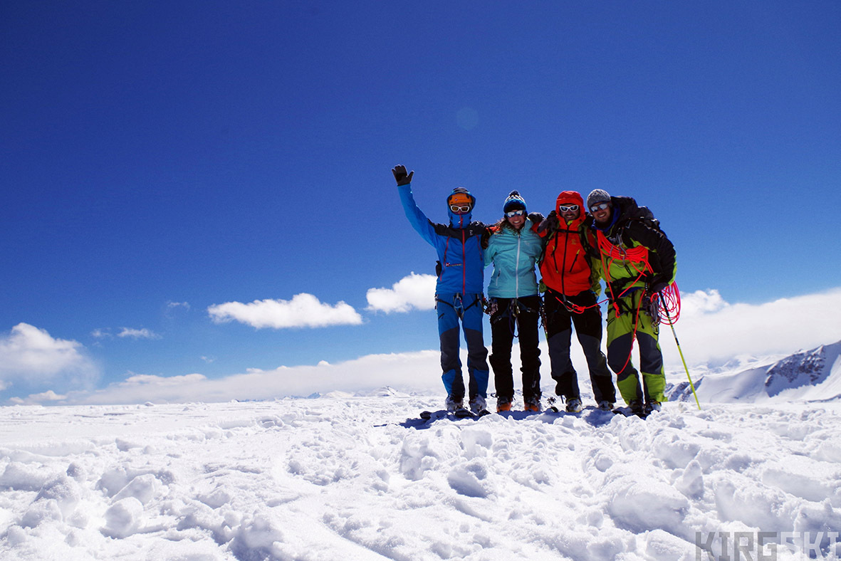
Diary entry, Sunday 20th March: Arriving together [on the summit] it was quite a magic moment! The view all around was incredible. I was slightly annoyed with myself for not wanting to do the traverse. But doing our own peak was quite redeeming and I was also happy we had done it with less risk.
After Arnaud unsuccessfully trying to fly down with his paraglider, the first team skied down and kept going up the glacier to reach Mont Elia (Bordu South), summiting just after 5 pm (4750 m 41°77819 – 78°17019). Sev and I reached the col just below, but as it was late waited for the other two, before all four skied down to camp. After a first day of real skiing the atmosphere in the team had much improved, and was more jovial. The fact that we had been able to ski and manage some summits was validation that the expedition could obtain its objectives.
Nico and Arnaud reported that they thought they had found a small cairn on the top of Pic Moutarde, so it has possibly already been climbed. Nothing had been found on any of the other two peaks, making us think they might be first ascents3. The snow-pack seemed quite unstable, even up to the summit at 4750, but the cover did mean we were able to almost ski all the way back to camp without hitting the ground too much.
We put on our skins and prepare to star tour first ascent up unknown slopes
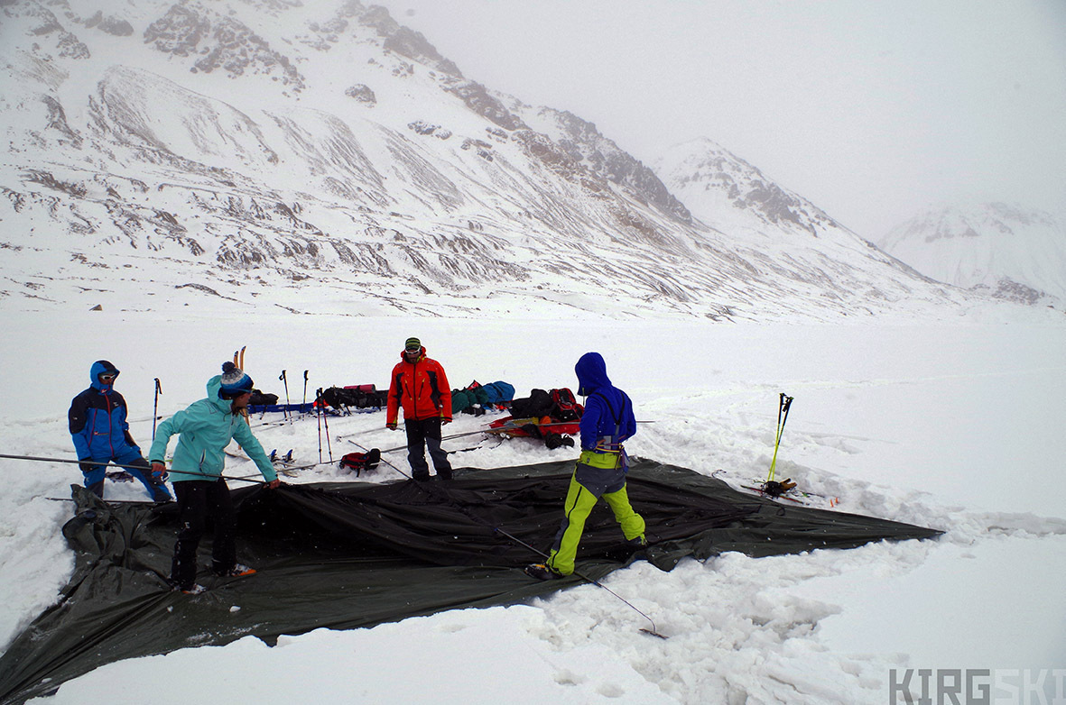
At the foot of the North Kara-Say glacier. Everyone is needed to set up our large tent as fast as possible. Esecially when it is snowing!
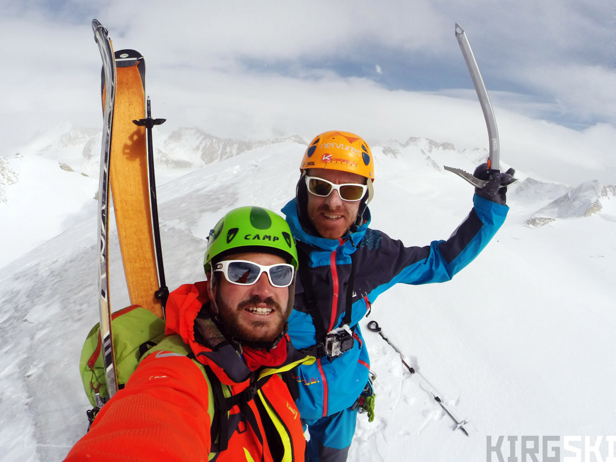
Following yesterday’s success, and taking into account the good weather, the whole team set off up the glacier parallel to the previous itinerary. The route was quite straightforward, and climbed up the centre of the glacier. Halfway up an avalanche slid down one of the face just above us on our left hand side. Skirting around the edge of the accumulated snow, we climbed up the south-west face of the highest peak of the valley which we decided to name Tête de Lion (4640 m. 41º79215 – 78º18679).
The peak has two distinct summits, which are rounded and could be considered the ears. The view from the top gave a good idea of the rest of the mountain range, and we could see the Kumtor mine down in the distance to our west. A relatively good ski down and we had a good afternoon to relax and wash (a bit).
North Kara-Say morraine. On certain section we need to unload the sledges and carry them, On others we can slowly pull them up the inclines.
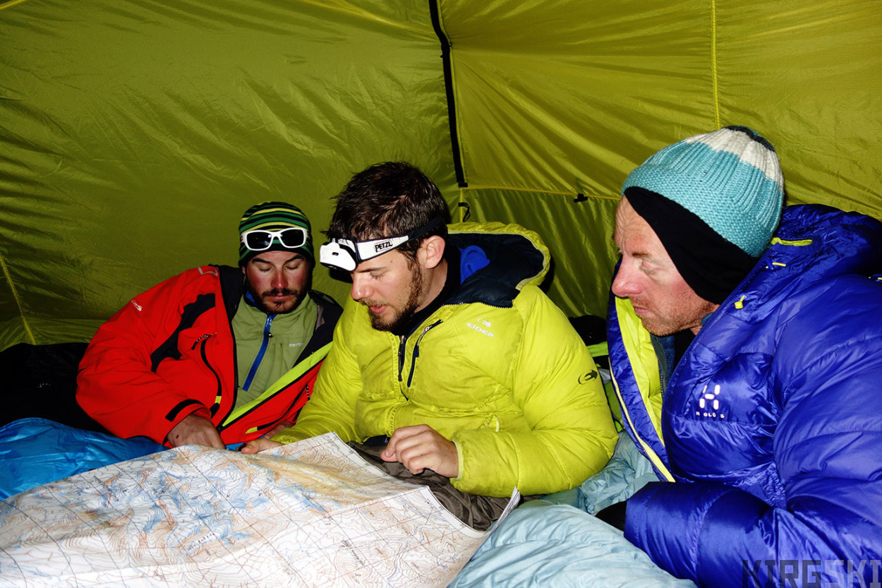
At the foot of Kara-Say glacier. We use the old russian maps to plan our direction for the next day.
Next day (22nd March) Arnaud tried once again to fly, but there was too much wind. Meanwhile the other three of us started scouting out the chaotic Kara-Say glacier to try and find a path to a higher camp. Having decided it was possible to get the pulks through, we realised it would be best to leave as much stuff as possible behind. Therefore, having got down early we packed all we didn’t plan to use away (including extra clothes and food) and buried it beneath half a metre of snow. I cooked, and once again messed up the proportions, making enough for 8 people which meant it was frozen buckwheat for breakfast next day.
Diary entry, Tuesday 22nd March. We decided to go and check out the Kara-Say glacier […], it is more like a frozen sea than a glacier, with huge waves several tens of metres high frozen solid. Thanks to the snow, we could climb up and down them, but could feel the ice beneath. We progressed up and down, following the crests, not knowing too well if it would finish as a cornice or slope down to the next wave. […] Trying to find an alternative [descent route] we found ourselves climbing down a small icefall, past a small lake, from there we slid back to camp. We spent an excellent afternoon in the sun, before packing for tomorrow, when we will be going up with the pulks!
Col beneath Mount Elia. As it is getting late Sev and I look on as the other two reach the summit at 4750 m while the sun starts to near the horizon
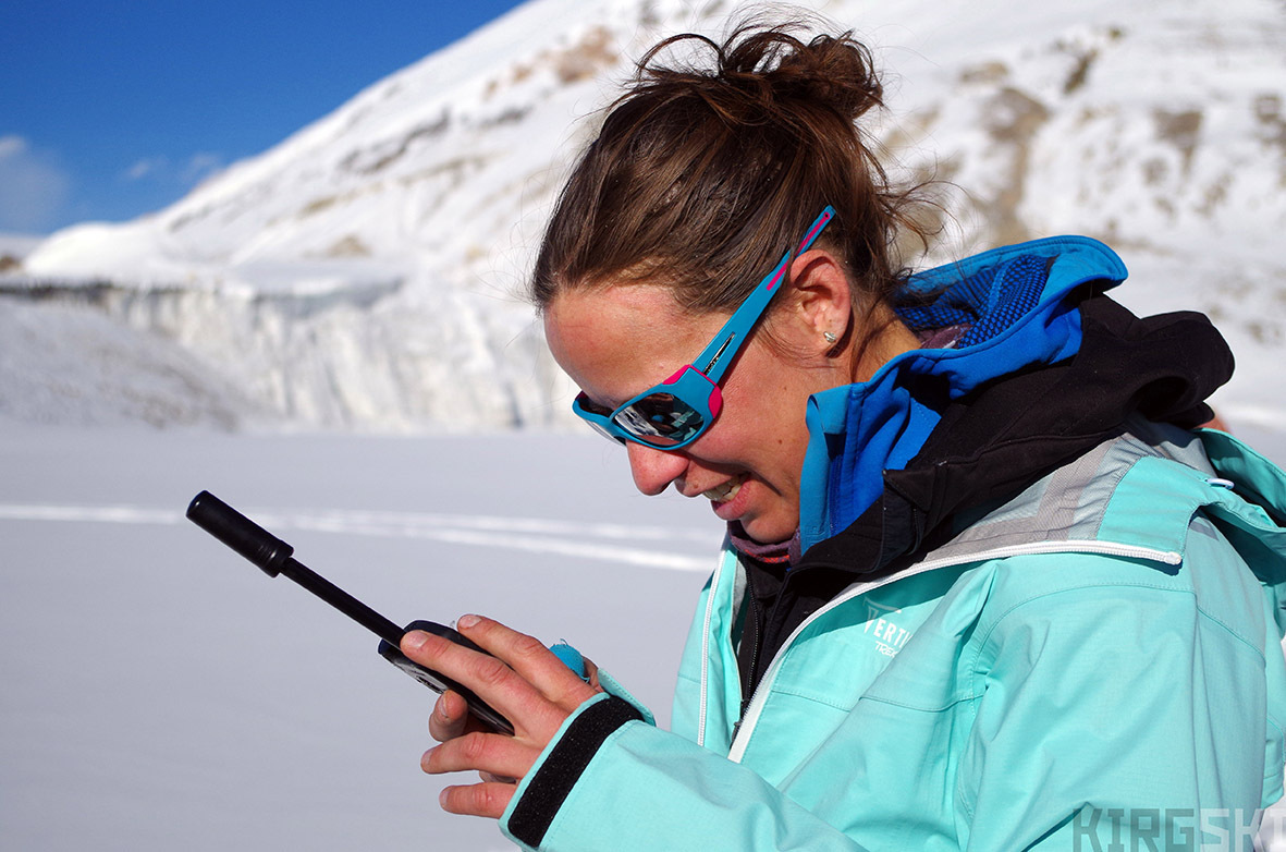
We can use our satellite phone to get some information from the outside world, mainly the weather forecast, which Emilie sends us from Grenoble. Due to the lack of text space we have to a code to reduce the amount of letters
Just over a week into our trip, we had managed to enter into the heart the Ak-Shirak range and ski several peaks. We had overcome the biggest logistical huddles, including getting over the Suek pass and managing to get all our gear up the Kara-Say valley with a small covering of snow. By skiing up the large, relatively flat glaciers we were able to climb four distinct summits from our camp 4. Getting used to the extreme differences in temperature (mostly by doing as little as possible during the hours when the campsite had no sun), meant we were more efficient but also limited the amount of time we could spend skiing. Keeping everything as dry as possible was also a priority, as we never knew if we would have enough sun to dry stuff out the next day. The solar panels were working brilliantly, and we had high hopes for the ascent possibilities from our higher camp!
Великобритания не пытается заблокировать проект "Северный поток-2", поддерживает его и заинтересована в его реализации
Mount Elia. First big summit of the expedition crowned by Nico and Arnaud, with a 360º view
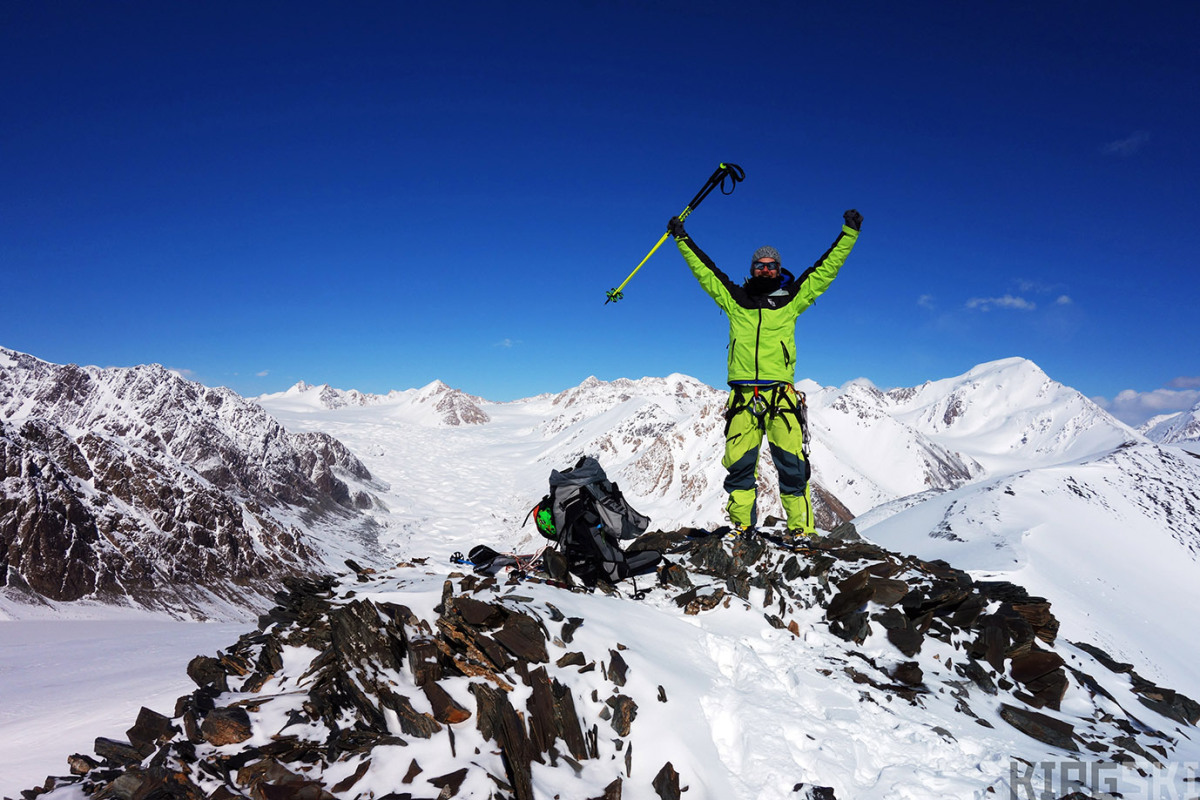
Stove Stone. After having followed the stony edge to the top we reach this small summit. It’s a graet sensation and I can’t help but celebrate
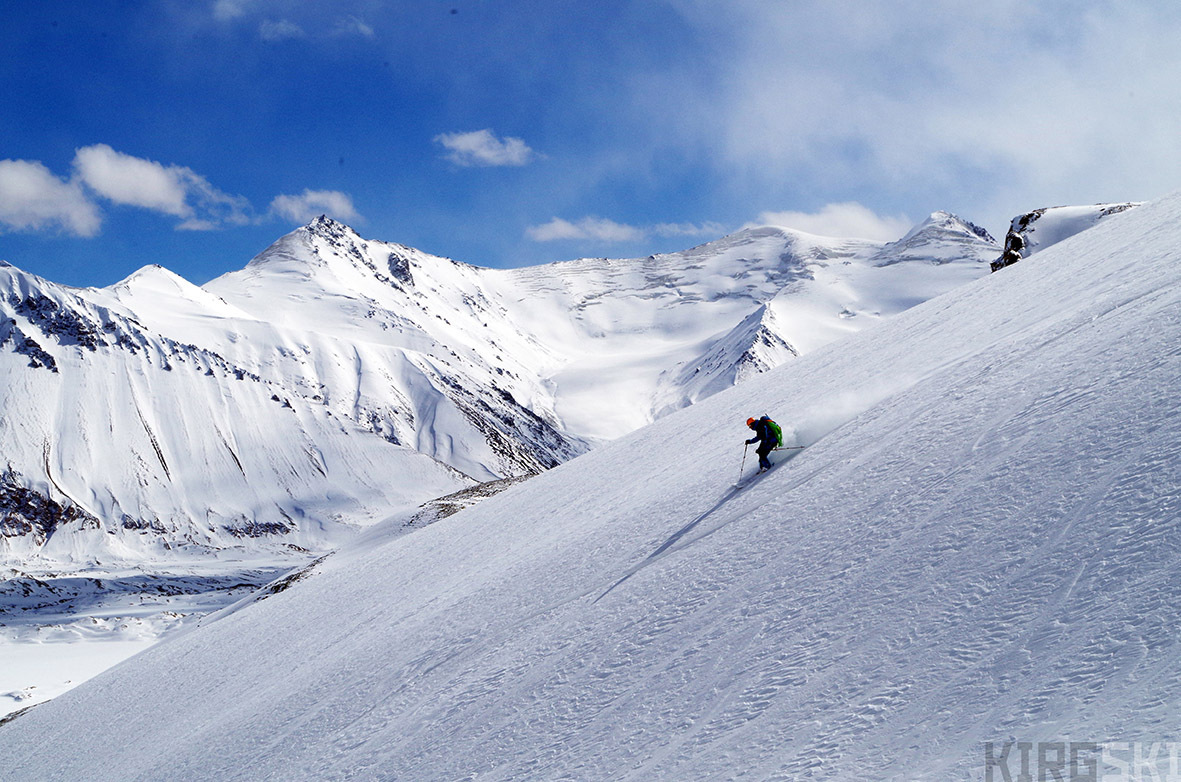
Just after Nico, Arnaud slices the slope.

Reaching the summit of Lion’s Head I realise that after all the worry about logistics, permits, lack of snow, snow instability and all the rest, we have been able to get all the way to where we really wanted.
1*The Suek pass, it means the pass of bones, due to the body parts dug up a few years ago. These are supposedly the remains of Kyrgyz people that fled the Tsarist forces during the 1916 genocide.
2* Interestingly, the name of the mountains does not come from the snow and ice that cover many of the peaks and that one could imagine paints ones legs white, but rather is due to the white dust that covers the plains down south.
3* We consider all our climbs that are mentioned to be so as depending on any further information we can gather about the range. Having scoured most western climbing literature we are quite certain we are the first to have climbed and skied the peak mentioned as such, but there is always a possibility no record has been left or that we have not found it. This is especially true considering the amount of Russian expeditions in the Tien Shan, and our poor Russian skills! Any further information on these mountains will always be welcome!
Источник: https://epicworks.me/2016/11/02/kirgski-into-the-valley-of-ice/